in the country!
Click the icons for info.
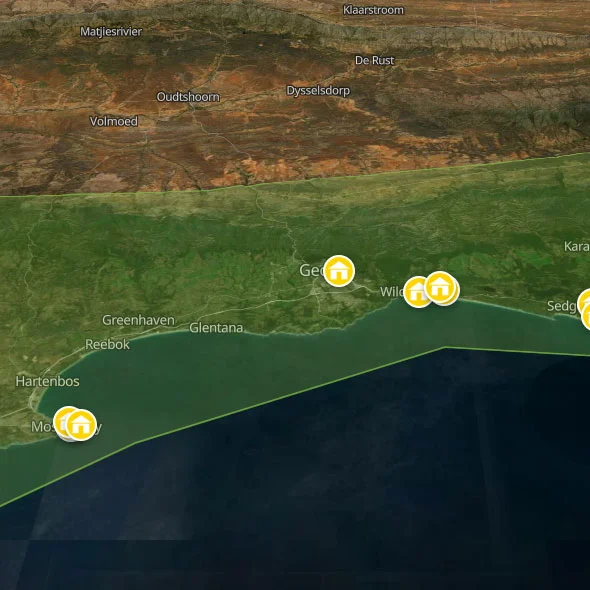
Welcome to our backpacking guide of the Garden Route!
Discover moreBackpacking the Garden Route
The Garden Route has a branding problem — not because the reality doesn't live up to the name, but because the name has become so thoroughly owned by the tourist industry that most travellers arrive with a postcard idea of it before they've set foot on it. They expect beauty, receive beauty, and leave having experienced a fraction of what is actually here. This guide is an attempt to fix that.
The route runs for approximately 300 kilometres along the south-eastern coast of South Africa, from Mossel Bay in the west to the Storms River mouth in Tsitsikamma in the east. In those 300 kilometres, you drive through one of the six recognised global floral kingdoms, two functionally distinct forest ecosystems found nowhere else in South Africa, a coastline that shifts constantly between wide lagoon beaches and sheer-drop dolerite cliffs, three separate sections of the Garden Route National Park, and enough gorges, rivers, passes, and lakes to fill three separate trip itineraries. It is, in the most literal sense, the most ecologically dense stretch of road in South Africa.
It is also a deeply human landscape, laid over a history of dispossession, forestry, and a century and a half of Afrikaner and English settler culture that still shapes the towns you pass through. Understanding both the ecology and the history makes the Garden Route far richer than its surface suggests.
Read More
The People of the Honey: Outeniqua and the First Inhabitants
Long before the first Dutch East India Company wagon rolled over the Outeniqua mountains in the late 17th century, this coastline was Outeniqua country. The Outeniqua — whose name comes from the Khwemãna term ǂGoatanikua, meaning "those who carry honey" — were a clan of the Khoikhoi (pronounced KOY-koy), the semi-nomadic pastoralists who had spread across southern Africa roughly 2,000 years before the European arrival. Outeniqua women were renowned across the region for their ability to locate wild bee hives in the forest canopy and carry honey over extraordinary distances, using ropes made from the bark of indigenous vines to climb directly into the trees. For centuries, the whole region was known as Outeniqualand.
The Khoikhoi were not the first humans here. Before them, the San people — the oldest continuous human lineage on earth, whose ancestors gave rise to all modern Homo sapiens — had occupied the southern Cape for tens of thousands of years. Rock art in cave shelters throughout the Garden Route region bears witness to their presence: fine-line paintings in ochre, white, and black depicting eland, human figures, and abstract images that researchers now understand as representations of hallucinatory trance states associated with San shamanic practice. The two groups coexisted, interacted, occasionally conflicted, and over generations intermixed, creating the complex Khoisan cultural mosaic that the Dutch encountered when they first penetrated the forests.
The distinction between Khoikhoi and San matters, though both were effectively destroyed as distinct peoples by European colonialism. The Khoikhoi were herders and owned cattle — the foundation of wealth and social structure — which made them an immediate target for Dutch dispossession. The San were hunter-gatherers, occupying territories and following game across ranges that the colonial settlers wanted for farms. Both were hunted, enslaved, dispossessed, and decimated by smallpox epidemics to which they had no immunity. By the early 19th century, the Outeniqua as a distinct group had effectively ceased to exist, absorbed into the growing coloured, Afrikaner, and slave-descended communities of the southern Cape. Their language is extinct. Their place-names survive everywhere: Outeniqua, Attaquas, Hessequa, Gouriqua, Gamtoos — the -qua suffix in Khoikhoi denoting "the people of." Every time you drive through Outeniqua Pass or follow the N2 through Hessequa territory, you are reading a ghost map of a world that was erased.
A small but growing movement of people in the Garden Route region now self-identify as Khoisan descendants — part of a broader national conversation about the political recognition of Khoisan heritage and land claims. In 2019, the Traditional and Khoi-San Leadership Act was signed into law, giving formal recognition to Khoisan leaders and councils for the first time since colonial annexation. It is a beginning, not a resolution; the question of land restitution for Khoisan communities in the Western and Eastern Cape is one of the most legally complicated and politically charged issues in contemporary South African land law.
The Woodcutters and the Forests: How the Garden Route Was Made and Unmade
The VOC (Dutch East India Company) established a post at what is now George in 1776 for a single purpose: timber. The Knysna and Tsitsikamma forests — then one of the largest temperate forest systems south of the equator — were the most valuable stands of hardwood on the African continent. Ironwood (Olea capensis), Stinkwood (Ocotea bullata), and Outeniqua Yellowwood (Podocarpus falcatus) were felled in their millions for shipbuilding, furniture, and construction. The woodcutters who worked the forests — mostly poor Afrikaner families who lived their entire lives in forest clearings, moving camp as each section was stripped — became one of the defining social groups of the southern Cape. Dalene Matthee's celebrated 1984 Afrikaans novel Kringe in 'n Bos (translated as Circles in a Forest) is the great literary account of their world, and the Knysna Forest trails are still named partly in their memory. The novel also touched on the elephants — and the role of the woodcutters in their near-extinction.
The forests that you walk through today in the Garden Route National Park are a fraction of what existed before the logging era. What you see — the great cathedral interiors of Outeniqua Yellowwood, Real Yellowwood, Cape Beech, and Ironwood — are the survivors, protected since SANParks' predecessors moved to halt commercial logging in the late 20th century. The forest regenerates slowly; a Yellowwood that stands 30 metres tall today may be 600 years old. Walking in the Diepwalle or Knysna forest sections is less a nature walk than a visit to a living remnant — which gives the experience a depth that a simply beautiful forest cannot match on its own.
The Ecology: Understanding What Makes the Garden Route Exceptional
The Garden Route occupies a unique ecological position on the planet, and understanding why adds an entirely different dimension to travelling through it. The region sits at the eastern edge of the Cape Floristic Region — one of the six global floral kingdoms and the only one occupying a single country, the smallest of the six in area, and by far the most diverse in relation to its size. The Cape Floristic Region contains approximately 9,000 plant species, of which nearly 6,000 are found nowhere else on earth. It has more endemic plant species per square kilometre than the Amazon basin. This is why the Garden Route's hillsides look the way they do — the seemingly infinite variety of shrubs, restios, heathers, proteas, and ground flowers that cover every exposed slope is not generic South African bush. It is a one-of-a-kind ecosystem that has evolved over millions of years in almost perfect isolation.
That ecosystem is called fynbos (Afrikaans: "fine bush"). Fynbos is characterised by a few defining plant families: the Proteaceae (proteas and pincushions), the Restionaceae (restios — the wiry, reed-like plants that give fynbos its distinctive texture), the Ericaceae (ericas, of which the Cape has more species than the rest of the world combined), and the Iridaceae (irises and gladioli, with over 1,400 bulb species recorded in the fynbos biome). Fynbos has co-evolved with fire: the majority of its species require periodic burning to germinate, and a properly managed fynbos hillside will go through roughly a 10–20 year fire cycle after which it rebuilds itself from seed. This biological dependency on fire has enormous management implications for the region, and is directly relevant to what happened here in June 2017 (see below).
Where the fynbos meets the sheltered river gorges and south-facing valleys, it gives way to the Afrotemperate forest — a completely different ecosystem, dark and humid, dominated by towering Yellowwoods, draped in Old Man's Beard lichen, threaded by streams running black with tannins from the leaf litter. This forest is the remnant of a forest system that once covered much of southern Africa. It is classified separately from tropical forest; it has no canopy layer of large predators, no great herds of megafauna, and its diversity is expressed not in mammals but in birds, insects, mosses, lichens, and plants. The Cape clawless otter, the bushbuck, the blue duiker, and the elusive Knysna turaco (whose crimson wing feathers are among the most intensely coloured in the bird world) are its signature animals. The forest and fynbos do not mix — they meet at sharp ecological boundaries and compete for space along riverbanks and hillsides in a way that is visible to anyone paying attention.
The Garden Route National Park — assembled from the old Wilderness, Knysna, and Tsitsikamma National Parks in 2011 — covers 140,000 hectares and protects 40,000 of the 65,000 hectares of indigenous forest in the southern Cape. It is not a park in the Kruger sense: there are no fences, no controlled entry points on most sections, and large areas of private land, pine plantation, and inhabited land are interspersed throughout the park boundary. This open-access structure has management advantages (the ecology breathes) and significant challenges (alien plant invasion, fire risk, and human-wildlife pressure are all consequences). The park received UNESCO Biosphere Reserve status in 2017 — the same year it nearly burned to the ground.
Strangefoot: The Last Elephant of the Knysna Forest
A thousand elephants once roamed the Knysna and Tsitsikamma forests. This is not ancient history — it is the 19th century, within the living memory of great-great-grandparents. The French naturalist François Le Vaillant shot the first recorded Knysna forest elephant in 1782 at Die Poort, between Plettenberg Bay and Knysna, setting in motion two centuries of ivory hunting, habitat destruction, and culling that reduced a thousand individuals to one. She is called Strangefoot (also known as Oupoort), named for the abnormal shape of her front feet. She is an adult female, confirmed alive as of early 2026 by SANParks camera traps that capture her image on average every three weeks, deep in the Diepwalle section of the forest.
Strangefoot is a conservation tragedy of the first order — the functional extinction of a distinct, forest-adapted population of African bush elephant (Loxodonta africana) through deliberate human destruction. The Knysna elephants were genetically distinct from savanna elephants; their behaviours, diet, and movement patterns had evolved over thousands of years in temperate forest rather than open bushveld. That library of adaptation is now contained in a single, ageing female. SANParks ecologist Lizette Moolman, who has monitored Strangefoot for years, describes her as highly evasive of human contact — she has learned, over a lifetime, that people mean danger. Of the two field rangers who have spent decades tracking her, Karel Maswati describes encounters with her as "almost spiritual." She will approach him calmly. She will not approach anyone else.
The question of what to do about Strangefoot is one of the most emotionally and scientifically complex conservation debates in South Africa. She is utterly alone; for a highly social, highly intelligent animal, this is, as the advocacy group Herd Instinct has argued, effectively a sentence of solitary confinement. The group, formed in 2024 by filmmaker Ryan Davy following his tracking of Strangefoot over twelve weeks, is pushing for the introduction of three to five young female elephants from the Plettenberg Bay Game Reserve to provide her company and begin the process of rebuilding a Knysna herd. SANParks is cautious: the Garden Route National Park is unfenced, private farmland abuts the forest on multiple sides, and a 1994 attempt to introduce companion elephants ended with one dying from stress pneumonia and two others requiring emergency relocation after destroying neighbouring farms. A Garden Route Elephant Management Plan was commissioned in 2024 to work through the options systematically. As of early 2026, no decision has been made. The debate continues, with Strangefoot moving silently through her forest, indifferent to all of it.
A note for visitors: Do not attempt to go looking for Strangefoot. SANParks has explicitly requested that people refrain from entering the Diepwalle forest sections to track her. She actively avoids human contact, and any attempt to find her is both a criminal offence (trespass in a National Park without permit) and a direct stress to an animal that has every reason to distrust people. The Knysna Elephant Park, located on the N2 between Knysna and Plettenberg Bay, is a separate, entirely different entity — it is a welfare facility for orphaned elephants from Kruger culls that offers educational interactions. It is worthwhile in its own right, but it has nothing to do with the wild Knysna forest elephant. Do not confuse the two.
June 2017: When the Garden Burned
On 7 June 2017, north-westerly winds of up to 120 km/h — hurricane force, unprecedented in the meteorological record for this region — drove wildfires through the Knysna and Plettenberg Bay areas in what became the worst natural disaster in the recorded history of the Garden Route, and one of the most severe on the African continent. In four days, approximately 15,000 hectares burned, including more than 5,000 hectares of commercial pine plantations and over 800 buildings. Seven people died. Ten thousand people were displaced. The fires melted car engines and incinerated houses so rapidly that residents had minutes to evacuate. Spot fires were thrown kilometres ahead of the main front, igniting communities that had believed themselves safe.
The disaster was not simply an act of extreme weather, though the weather was genuinely extreme. The Canadian Fire Weather Index values recorded on the day of the fires were the highest in the 79-year instrumental record, the culmination of an 18–24 month drought that was itself the worst on record for the southern Cape. But the severity — the reason the fire became the catastrophe it did rather than a manageable emergency — was the fuel. Pine trees had invaded more than 90% of the Garden Route National Park's fynbos vegetation at various densities. Decades of fire suppression, carried out to protect the commercial timber industry and an expanding residential population, had allowed fuel loads in the natural fynbos to triple what they would have been under a natural fire cycle. More than half the area that burned was commercial pine plantation or natural vegetation invaded by alien trees. The fynbos, which evolved with fire and needed it, had been denied it for too long. When the wind came, there was nothing to stop what happened.
The region has recovered visually — the hills around Knysna and Plettenberg Bay are now blanketed in new growth, and to a first-time visitor, the landscape looks entirely lush and undamaged. But the underlying structural problems have not been resolved. Invasive alien plant species — black wattle, pine, and eucalyptus — grew back faster and more aggressively than native fynbos in many fire-affected areas. Conservation managers warn that the same conditions that made the 2017 fires so devastating are reassembling: fuel loads rebuilding, invasive plant biomass increasing, and climate projections indicating a trend toward hotter, drier berg wind events in the southern Cape. The 2017 fires have not been erased from the Garden Route's story. They are the most important thing that has happened here in living memory, and they have changed how the region thinks about its future.
Navigating the Route: Towns, Sections, and How to Move
The N2 is the Garden Route's spine. From Mossel Bay in the west to Storms River in the east, the national highway runs broadly parallel to the coast, with towns arranged along it at intervals of roughly 30–50 kilometres. The route is perfectly driveable in a single long day from Cape Town (approximately 450km to Storms River), but doing so defeats the purpose entirely. The Garden Route rewards the traveller who spends two weeks rather than two days. Here is the structure of what you will encounter heading east:
Mossel Bay: The Historical Gateway
Mossel Bay is where Bartolomeu Dias first made contact with the Khoikhoi in 1488, making it one of the oldest documented meeting points between Europe and sub-Saharan Africa. The town has a functioning commercial harbour, a respectable surf scene, and the Dias Museum Complex, which houses a full-scale replica of Dias's caravel. The old part of town near the Point, with its historical dressed-stone buildings, is perhaps the most beautiful town on the route, and its history is underrated, making it a solid first overnight stop coming from Cape Town.
George: The Route's Capital
George is the Garden Route's largest city and administrative hub, with its own airport (GRJ) — the most useful entry point if you're flying in rather than driving. It is not a backpacker destination in itself, but it functions as the region's services base (banks, supermarkets, hospitals, car rental) and as the northern gateway to the Outeniqua Pass and the Klein Karoo beyond. The Outeniqua Pass itself — built partly with Italian prisoner-of-war labour in the 1940s — is a spectacular piece of mountain road engineering that takes you 800 metres from the coastal plain over the fold mountains to Oudtshoorn in about 30 minutes.
Wilderness and the Lakes District
Wilderness is the most underrated town on the Garden Route. It sits in the Wilderness Section of the National Park, a system of lakes, lagoons, rivers, and estuary that is one of the most important waterbird habitats in the Western Cape. The main lake system — Swartvlei, Langvlei, Rondevlei, and the Touw River estuary — supports half-collared kingfishers, African fish eagles, great white pelicans, and the spectacular Knysna turaco. Wilderness is calm, small, and ecologically extraordinary. Most backpackers drive straight through it on the way to Knysna. Don't.
Knysna: The Jewel and Its Complications
Knysna is the town that defines the Garden Route in the popular imagination, and with good reason. The lagoon — one of the largest natural lagoons in South Africa, entered from the sea through a narrow passage between two sandstone headlands called the Heads — is one of the most beautiful bodies of water in the country. The town itself is prosperous, well-designed, and animated by a year-round festival calendar (the Oyster Festival in July is the most famous, but the Knysna Literary Festival, the Pink Loerie Mardi Gras, and the Cycle Tour are all significant events). The historic Waterfront, the forests to the north, the ferry to the Featherbed Nature Reserve, and easy access to the Diepwalle hiking trails make Knysna the natural base for 2–3 nights on the route. Its hostels are among the best in the region.
Two complications worth knowing: first, Knysna has become significantly more expensive over the last decade, driven by a wave of affluent Cape Town retirees and second-home buyers. Budget accommodation, while available, is squeezed at the margins of a town that increasingly caters to the R3,000-a-night guest house market. Second, some of the most photographed parts of Knysna — particularly the Heads — are actually in the Featherbed Nature Reserve, accessible only by a commercial ferry and guided tour (approximately €15 per person). The views from the eastern Head, reached by a short drive and a walk along the cliff path, are free and arguably better. Don't pay for what you can get for nothing.
Plettenberg Bay: Beauty with a Caveat
Plettenberg Bay ("Plett") is the most beautiful town on the Garden Route in terms of pure beach geography — two wide, surf-beaten beaches flanked by a dramatic rocky headland, with the Keurbooms River estuary to the east and forest-covered hills as a backdrop. It is also the most expensive and the most divided. "Plett" proper — the boutique hotels, the Robberg Nature Reserve, the whale-watching cruises — caters to a wealthy South African and international holiday market. The township of Bossiesgif on the other side of the highway tells a different story. For backpackers, Plett works best as a 1–2 night stay focused on Robberg and the beach. The hostel scene is smaller than Knysna but of good quality.
Nature's Valley and the Tsitsikamma
The eastern end of the Garden Route is its wildest and most spectacular. Nature's Valley is a tiny, deeply peaceful village at the western end of the Otter Trail, reached by a dramatic mountain road off the N2. It has a spectacular beach at the lagoon mouth, a small shop, a few accommodation options, and essentially nothing else — which is precisely its appeal. From Nature's Valley, the N2 climbs back into the Tsitsikamma mountains before descending to the coast at Storms River Mouth, the most dramatic section of coastline on the entire Garden Route: a narrow canyon where the Storms River drives between black rock walls before meeting the Indian Ocean in a chaos of foam. The suspension bridge over the river mouth, the tidal caves, and the beginning of the Otter Trail all start here.
Garden Route FAQs For Backpackers
Do I need a car?
More than almost anywhere else in South Africa: yes. The Garden Route has the best intercity bus connections of any regional destination outside Cape Town and Johannesburg — Intercape, FlixBus, Greyhound and the Baz Bus all run along the N2, connecting Mossel Bay, George, Wilderness, Knysna, Plettenberg Bay, and Storms River. For a backpacker travelling the main town-to-town circuit and relying on hostels to arrange activities, this is workable. But the things that make the Garden Route worth the trip — the forest trails, the passes, the lakeside picnic spots, Nature's Valley, the drive through the Outeniqua and Grootrivier Passes — are inaccessible without a car. A hire car for two weeks is the single best investment you can make on this trip. Split between two people, it is often cheaper than the bus and gives you a completely different journey.
George Airport (airport code GRJ) is the most useful entry point for a Garden Route road trip. Flights from Cape Town take 45 minutes. From the airport, it is a 5-minute drive into George, where all the major car hire companies are represented. From George, Storms River is 2 hours east. Mossel Bay is 45 minutes west.
What time of year is best?
The Garden Route's climate is famously temperate year-round — its position in a rain shadow between the Cape's winter rainfall zone and the summer rainfall zone of the Eastern Cape means it receives rain in all seasons, and temperatures rarely fall below 10°C in winter or climb above 28°C in summer. There is no genuinely bad time to go, but there are better and worse windows for specific activities:
October–April (spring and summer) brings the warmest sea temperatures for swimming, the most reliable surfing conditions, and the highest wildflower diversity. It is also peak South African holiday season, meaning the popular beaches and hostels are at their busiest and most expensive in December and January.
May–September (autumn and winter) is the best window for whale watching (southern right whales calve in Plettenberg Bay's sheltered bays from June to November), for hiking (cooler, lower humidity, trail surfaces drier), and for the Otter Trail, which is easier in cool weather. The Knysna Oyster Festival runs in July. Accommodation is cheaper and less crowded. The main risk is higher rainfall in August and heavy mist in the forests, which is either atmospheric or miserable depending on your disposition.
How much does it cost?
The Garden Route sits in the mid-range tier for South African backpacker budgets. Dorm beds in well-equipped hostels typically run €10–€18 per night. Activities are where costs accumulate quickly: bungee jumping (€85–€100 for Bloukrans), whale-watching cruises (€35–€50), the Featherbed Nature Reserve ferry (€15), kayaking tours (€20–€35). Budget roughly €60–€90 per day if you are doing activities daily, or €30–€40 if you are relying on free hiking and beach time. The Otter Trail is the most significant single expenditure: approximately €80–€90 per person for the 5-day permit and hut accommodation, plus the cost of getting yourself to the start and from the finish.
What is the Otter Trail, and how hard is it to get a permit?
The Otter Trail is South Africa's oldest and most famous multi-day hiking trail, running 42km along the Tsitsikamma coastline from Storms River Mouth to Nature's Valley over 5 days. It is, by widespread consensus, one of the finest coastal walks in the world — traversing sea-level rock shelves, climbing to 200m clifftop plateaux, crossing four rivers (two of which require swimming your pack across at low tide), and passing through both Afrotemperate forest and coastal fynbos. Maximum group size is 12; a maximum of 12 hikers start per day. The result is that the trail feels empty and wild even at capacity.
The permit situation is the most important practical thing to know: permits sell out up to a year in advance for peak months. If you want to do the Otter Trail in July or December, you need to book twelve months ahead, with excellent clicking speed, on the SANParks online reservations system (sanparks.org). However, solo travellers and pairs should check the site regularly for cancellations — spots for 1–2 people become available with much shorter notice than group slots. The trail costs approximately €80–€90 per person for the 5-day permit inclusive of hut accommodation. A doctor's medical certificate is compulsory — SANParks has made this a hard requirement, and there are real consequences if you show up without it. Age restrictions apply: minimum 12, maximum 65 (over 65 requires a doctor's clearance). There is no mobile signal on the trail. Water is available from streams but treat it — the Kleinbos River water on Day 2 is explicitly not safe to drink.
What are the best free things to do?
The Garden Route's best experiences are disproportionately the free ones. The Diepwalle forest elephant trail system (hiking, free with a park entry fee of approximately €5), the Wilderness lakeside walk, the Robberg Nature Reserve clifftop circuit in Plettenberg Bay (small entry fee, approximately €3), the Storms River Mouth suspension bridge and tidal caves walk (included in National Park entry), the Outeniqua Pass drive, and the simple act of sitting on any of the dozen beaches between Wilderness and Nature's Valley at sunset — all of these cost nothing or next to nothing and are as good as anything on the paid activities list.
Safety On The Garden Route
The Garden Route is one of the safer regional destinations in South Africa, by a significant margin. The combination of relatively affluent towns, a high density of tourism infrastructure, and a well-functioning Western Cape provincial government means that the levels of violent crime that affect parts of the Wild Coast, the Johannesburg metropolitan area, and the Cape Flats are not a primary concern on the Garden Route. That said, South Africa is not Europe, and complacency is always a mistake. Here is an honest assessment of the risks.
Petty Theft
Car break-ins are the most common crime affecting tourists on the Garden Route. Do not leave anything visible in a parked car — not a jacket, not a charger cable, not an empty bag. This applies especially at trail parking areas, beaches, and viewpoints. At busier spots, informal car guards operate; the standard tip is R10–R15 (approximately €0.50–€0.80) when you return. It is a small price for the psychological assurance, and it provides meaningful income.
Phone snatching occurs in the towns, particularly around the Knysna Waterfront, the Plettenberg Bay beach access paths, and the main commercial streets of George. The standard advice applies: keep your phone in your pocket, not in your hand. Don't walk while staring at your screen. If you need to check a map, duck into a café.
Specific Areas To Note
George town centre (after dark): George's CBD — particularly the streets immediately surrounding the main taxi rank on Courtenay Street — can be uncomfortable at night for solo travellers, especially women. The area is busy and functional during the day but empties and becomes less safe after approximately 8:00 PM. The tourist areas of George (the Outeniqua Farmers' Market area, the coffee shops on Meade Street) are perfectly fine. The distinction is between the commercial core and the taxi and transport hub areas.
Knysna industrial area and informal settlement edges: The township areas of Knysna — particularly Thembalethu, which borders the main tourist zone — should be navigated thoughtfully after dark. The main tourist strip, the Waterfront, and the forest areas are all safe for independent movement. The edges of the town where tourist and township areas meet require more awareness.
Plettenberg Bay beaches at night: The beach access paths between the main Plett beachfront and the surf spots to the east are isolated after dark. Walk these in groups or take a taxi rather than walking alone after sunset.
Natural Hazards
Rip currents: The Garden Route's surf beaches — particularly Victoria Bay, Buffalo Bay, and the main Plettenberg Bay beach — have powerful shore breaks and rip currents. Swim between the flags on patrolled beaches. Robberg Beach and the beaches at Nature's Valley are exposed and unpatrolled; treat them with respect. The lagoon beaches at Wilderness, Sedgefield, and the Knysna lagoon are calm and safe for families and non-swimmers.
Fires: Given the events of June 2017 and the ongoing accumulation of fuel loads across the National Park, wildfire is a real hazard on the Garden Route, particularly in late summer after a dry spell combined with strong berg wind conditions. If you are hiking in the fynbos or forest in hot, dry, windy conditions, pay attention to any smoke you smell — fires can move very fast in fynbos. The Otter Trail and other multi-day routes have emergency escape routes marked on the maps; know where they are before you start. The GRNP emergency number (available at the Storms River Mouth gate and from hostel noticeboards) should be saved in your phone.
Bloukrans River crossing on the Otter Trail: On Day 4 of the Otter Trail, the Bloukrans River crossing is the trail's most technically demanding moment. The river must be crossed by swimming, with your pack raised above your head or in a waterproof bag, timing the crossing to coincide with low tide. At high tide, the crossing is impossible and potentially fatal. Obtain a tide table before you start the trail and plan Day 4's schedule around it. This is not advisory — it is essential. The emergency escape route E6 provides an alternative if the crossing is not feasible, but using it means missing the final section of the most beautiful day on the trail.

Things To Do On The Garden Route

1. The Adventures (High Adrenaline)
The Garden Route is one of the most adventure-dense stretches of road in the world. Within a 300km corridor, you can bungee jump from the highest commercial bridge jump on the planet, surf a perfect point break, cage-dive with great white sharks, paraglide over a lagoon, kloofing into waterfall pools, and skydive above one of the most beautiful coastlines on earth. The infrastructure for all of this is excellent, the operators are professional, and the prices — by European and Australian standards — are startlingly affordable.
Read More
Bloukrans Bridge Bungee Jump
At 216 metres above the Bloukrans River gorge, this is the highest commercial bungee jump in the world, and it is on the N2 between Plettenberg Bay and Storms River. The jump itself takes approximately three seconds of freefall, during which you will briefly travel at around 160km/h. The site is well-organised, the operators (Face Adrenalin) have an excellent safety record, and even if you decide at the last moment not to jump, the bridge walkway offers some of the most vertiginous views in the country. Cost approximately €85–€100. If your budget is tight, the bridge walk without the jump costs around €20 and is its own impressive experience.
Surfing Victoria Bay
Victoria Bay ("Vic Bay") is a tiny cove approximately 9km south of George, reached by a narrow road that drops steeply to a beach barely wide enough for thirty people. It is one of the best right-hand point breaks in South Africa, producing long, hollow, fast waves on a south-westerly swell that hold their shape all the way to the end of the bay. It is not a beginner spot — the take-off is steep and the rocks are real — but experienced surfers who find it on the right day describe it as among the best waves they have ever surfed. It is also one of the most beautiful surf spots on the continent: a small caravan park on the clifftop, a single café, and the bay entirely surrounded by forested hillside. If you are not a surfer, come anyway at sunset.
Shark Cage Diving (Great White)
The Garden Route does not have the dense Great White population of Gansbaai (on the Overberg coast to the west), but there are established cage diving and shark snorkelling operations out of Mossel Bay and Plettenberg Bay that are excellent. The Mossel Bay operators work with a consistent population of Great Whites, Bronze Whalers, and the occasional Seven-Gilled Cow Shark in Seal Island waters. Operations run year-round, weather permitting. Cost approximately €90–€130 per person for a half-day excursion. You do not need to be a diver; the cage operates at surface level.
Zip-Lining and Forest Canopy Tours
Several operators in the Knysna and Tsitsikamma areas offer zip-line tours through the forest canopy — a series of cables strung between platforms built into the Yellowwood and Ironwood trees, allowing you to travel through the upper layer of the forest at speed, 20–30 metres above the forest floor. It is more fun than it sounds, and the perspective on the forest from canopy height is genuinely different to anything you experience on foot below. The Knysna Ziplines operation is the most established; cost approximately €60–€70.
Paragliding from the Outeniqua Mountains
Tandem paragliding is available from several launch sites above George and Wilderness, where the consistent south-easterly sea breeze provides reliable lift along the mountain face. On a clear day, a tandem flight from the Outeniqua crest takes you out over the lakes district of Wilderness and the Indian Ocean beyond — one of the most beautiful aerial views on the continent. Cost approximately €80–€100 for a 20–30 minute flight. No experience required.
Kloofing (Canyoning) in the Storms River Gorge
"Kloofing" — the South African term for canyoning: climbing, jumping, swimming, and abseiling through river gorges — is one of the wildest activities on the Garden Route and one of the least well-known internationally. The Storms River gorge offers world-class kloofing through narrow slot canyons with deep emerald plunge pools, waterfall jumps of up to 8 metres, and sections where the gorge walls close to barely a metre apart. Several operators run half-day and full-day guided kloofing trips from the Storms River village and from Tsitsikamma Backpackers. Cost approximately €40–€65 for a guided half-day. This is a seriously physical activity — be honest about your fitness and swimming ability when booking.
Whale Watching from Plettenberg Bay
Plettenberg Bay is one of the best land-based and boat-based whale watching destinations in the world between June and November. Southern right whales use the bay as a calving ground, arriving in May–June and remaining until October–November. They are frequently visible from the beach at Robberg without binoculars, breaching and playing in the surf zone in groups of 2–4. Humpback whales pass through on their annual migration from July onwards. Bryde's whales are present year-round. For boat-based viewing, Ocean Safaris and Ocean Blue Adventures both run responsible 2-hour whale-watching trips from the Beacon Island beach launch (approximately €35–€45 per person). They also encounter bottlenose and common dolphins on virtually every trip, and Cape fur seals on the rocks at Robberg. In good years, this is the best value wildlife experience on the Garden Route.
2. The Hiking (The Garden Route's Finest Hours)
The Garden Route's hiking is its greatest underrated asset. Most visitors see the beach and the bungee; the best of the region is discovered on foot.
The Otter Trail (Storms River Mouth to Nature's Valley, 5 days / 42km)
South Africa's oldest official hiking trail and, by widespread consensus, the finest coastal walk in the southern hemisphere. The route traverses the Tsitsikamma coastline from Storms River Mouth to Nature's Valley through a landscape of near-vertical cliff faces, hidden beach coves, ancient forest, and coastal fynbos. Day 4 is the hardest and most beautiful: a long traverse to the Bloukrans River crossing that must be timed to low tide, involving swimming your pack across a river mouth with the Indian Ocean swell surging around you — one of the most memorable moments available in South African hiking. There is no mobile signal on the trail. Permits sell out up to a year in advance for peak months. Book as early as possible. See the FAQ section above for full details.
Robberg Nature Reserve (Plettenberg Bay, 3 circuits / 9km maximum)
The Robberg Peninsula juts into the Indian Ocean just south of Plettenberg Bay, forming a dramatic 4km headland of cliff, fynbos, and secluded beach. Three walking circuits — the short Point Circuit (approximately 2km), the medium Island Circuit (approximately 5.5km), and the full Peninsula Loop (approximately 9km) — navigate the headland's clifftops and beaches, passing a massive Cape fur seal colony at the tip (7,000+ animals during peak season), and offering views that, on a clear day, extend as far as Cape Seal to the east. The Point Circuit is one of the best short walks anywhere on the South African coast. Small entry fee of approximately €3. Book at the Robberg information centre at the trailhead; day visitor numbers are capped.
The Diepwalle Forest Trails (Knysna, 3 loops / up to 19km)
The Diepwalle section of the Garden Route National Park is the heart of the Knysna forest system, and its trail network is among the most atmospherically beautiful walking in South Africa. Three loop trails navigate the old-growth forest floor: the red route (9km, the most popular), the blue route (7km), and the yellow route (3km). The centrepiece of the red route is the Big Tree — an 800-year-old Outeniqua Yellowwood that stands 39 metres tall and has a circumference of 9 metres. You will walk on a forest floor carpeted in fallen leaves and traversed by sunlight filtered through a canopy of 600-year-old trees. This is also the section of forest where Strangefoot moves. You will not see her. But you are in her territory, and that is worth something. Park entry fee approximately €5; the trail is free with entry.
Storms River Mouth Walks (Tsitsikamma, free with park entry)
The suspension bridge walk at Storms River Mouth is one of the most visited sites on the Garden Route, and the crowds at peak season are a real drawback — but the landscape justifies them. Two suspension bridges cross the Storms River canyon where it meets the sea, with the gorge walls rising vertically on both sides and the river running black beneath. The longer Blue Duiker Trail (11km, through coastal forest to a waterfall) and the Waterfall Trail (1.3km return, to a series of cascades in the forest) are both uncrowded and beautiful. The swimming in the tidal pools beside the rest camp is excellent.
The Outeniqua Hiking Trail (8 days / 108km)
For serious hikers who want a full wilderness experience, the Outeniqua Trail traverses the mountain range behind the Garden Route towns from north of Mossel Bay to Diepwalle near Knysna, climbing through fynbos into afromontane forest and back down. At 108km over 8 days, with daily distances of 12–18km and significant elevation gain, it is a substantial commitment. Permits through the GRNP (Knysna section); maximum 30 hikers per day. Book well in advance for school holiday periods. This trail was heavily affected by the 2017 fires in its western sections, and some route alterations remain in place; check current trail status with SANParks before booking.
The Half-Collared Kingfisher Trail (Wilderness)
One of the most enchanting walks on the entire Garden Route, and criminally under-visited. The trail — which is not free, but is extremely good value — starts at Fairy Knowe Backpackers and winds through a tunnel of ancient forest so dense and layered that, especially for visitors from Europe or the Americas, the effect is genuinely Tarzan-in-the-jungle: enormous yellowwoods draped in moss, creeper-tangled understorey, sunlight arriving in oblique shafts. The trail includes a boardwalk section along the Touw River, leads to a beautiful waterfall, and features one of the more memorable moments available on the Garden Route — a river crossing by pontoon, which you pull yourself across by rope. It takes about three hours at a comfortable pace. Pack a picnic to eat at the waterfall. The trail is named for the half-collared kingfisher (Alcedo semitorquata), one of the most brilliantly coloured birds in South Africa and a resident of the Touw River banks — look for a flash of electric blue and orange low over the water.
The Seven Passes Road (George to Knysna, 75km)
While everyone drives the N2, relatively few visitors take the time to find the older road that ran between George and Knysna for 70 years before the highway superseded it in 1952. The Seven Passes Road — a declared national monument — is arguably the most beautiful driving route in the Western Cape, traversing seven river gorges through some of the most pristine indigenous forest in South Africa. It was engineered between 1867 and 1883 by two brothers-in-law, the master road-builder Thomas Bain (working from the Knysna end) and Adam de Smidt (from George), apparently in such fierce disagreement over the route that they never spoke to each other again. Before the road existed at all, ox wagons navigating between George and Knysna had to descend almost vertically into river gorges on braked wheels, the wagons carving grooves more than two metres deep into the ground. The road was built to replace this ordeal. The result — narrow, winding, forested, with Victorian stone bridges over every river — feels like a road from another century. That is because it is.
The full route runs roughly 75km from the Saasveld campus outside George to Phantom Pass just west of Knysna; most of it is gravel, though the section through the western passes near George is tarred. Note that a section between the NMU/Saasveld campus and Wilderness Heights has been subject to ongoing repair work following flood damage, and road conditions may vary — check locally before setting out. For cyclists, this is one of the finest rides in South Africa. On foot, sections of it — particularly the passes themselves — are excellent for walking, away from any meaningful traffic. You do not need a 4x4; a standard car handles it fine in dry conditions. The costs are petrol and time, and the payoff is spectacular.
The Kaaimans Railway Walk: Wilderness to the Grotto (Free)
For as long as the railway line remains disused, one of the most unusual free walks in South Africa is available on the Garden Route. Starting from the parking area at the western end of Wilderness (off Sands Road, near Fairy Knowe Backpackers), you pick up the old Outeniqua Choo-Tjoe railway line and follow it westward into a landscape of cliff faces, sea views, and forest. When you reach Wilderness village, you'll need to cross the N2 by walking through the tunnel at the petrol station. After a total of 4km you pass through the first tunnel and arrive at the Kaaimans Grotto — a large sea cave beside the old Kaaimans River Railway Bridge, now home to an extraordinary eccentric artwork installation and makeshift museum created by a man called Clifford Brandon, who moved into the cave in 2006. Shell chandeliers, religious iconography, mannequins, and collected objects fill room after room. A resident will give you a tour. It costs about ZAR25 to have a look around — this is someone's home and life's work, not a tourist infrastructure. Beyond the grotto, the line continues over the Kaaimans River bridge to a second and third tunnel and eventually to Victoria Bay, the whole walk clocking roughly 2.3km from the Wilderness parking area. However, the Kaaiman's River Bridge is all rusted away and not safe to walk on.
Time-sensitive: This walk is only possible because the railway line has been closed since flood damage in 2006. That is now changing. In October 2025, Classic Rail signed a 25-year concession with Transnet to restore and reopen the Outeniqua Choo-Tjoe as a tourist steam train, and track-clearing work began at Sedgefield in December 2025. The first phase (Knysna to Sedgefield) is expected to open around late 2026; the George–Sedgefield section follows. Once the train is running again, the line will no longer be walkable — at least not legally. If this walk appeals to you, do it on this trip. It is one of those things that will not be available indefinitely.
The Wilderness to Sedgefield Lake Walk (Free, ~20km)
This is the walk to do if you want a full day out and a genuine sense of moving through real southern Africa rather than tourist Africa. Starting in Wilderness, the route follows dirt roads through the lake district — past Rondevlei, Swartvlei, the river mouths and reeds — all the way through to Sedgefield, roughly 20km in total. It is entirely flat. The vegetation alternates between fynbos, riverine forest, and the open water margins of the interconnected lake system that makes the Wilderness-Sedgefield corridor one of the most important wetland habitats in the Western Cape. You will walk for long stretches without seeing another person. Birdlife is exceptional. The road surfaces are good and it is straightforward to navigate. Anyone in reasonable physical shape can do it; you do not need to be an experienced hiker. Bring water, food, and sun protection, and arrange a car or lift at the Sedgefield end unless you want to walk back. It also makes an excellent bike ride.
At the Sedgefield end, if you have time and energy remaining, the Cape Dune Molerat Trail is a short, easy walk through coastal dune forest near the town. It sounds unglamorous — the cape dune molerat is an underground-dwelling rodent not known for photogenic appearances — but the trail itself is genuinely lovely, with good fynbos and views over the coast. Do not be put off by the name.
Mossel Bay: The Most Underrated Town on the Route
Most people treat Mossel Bay as a service stop — the western gateway to the Garden Route, a place to fill the tank and collect a hire car. This is a mistake. The modern parts of the town are unremarkable, and for years an oil rig anchored in the middle of the bay was a reliable conversation-stopper. The rig is gone now. What remains, in the old quarter between the Point and the harbour, is arguably the most atmospherically beautiful town centre on the South African coast — a dense collection of historic dressed-stone buildings from the colonial era, unhurried, sun-saturated, and suffused with the kind of quiet provincial pride that larger tourist towns tend to lose.
There is more to do here than the town's reputation suggests. The St Blaize Hiking Trail follows the clifftops south of town for 13.5km, with the Indian Ocean on one side and fynbos on the other, and passes the Point of Human Origins cave — a real archaeological site where evidence of some of the earliest symbolic human behaviour (ochre use, shellfish harvesting, engraved geometric patterns) has been excavated and dated to around 164,000 years ago. It is one of the most significant archaeological sites in the world, presented accessibly at the Pinnacle Point caves complex. The harbour area is excellent — boat rides, waterfront restaurants including, genuinely, a decommissioned double-decker bus that has been converted into a restaurant — and Santos Beach is one of the most beautiful town beaches on the south coast, sheltered and wide, with the kind of light in the late afternoon that makes everything look like a postcard. The water is colder than in Durban (this is the Indian Ocean meeting the Agulhas current rather than the warmer sub-tropical coast further north), but for swimming it is perfectly fine on a warm day.
If you are driving the Garden Route from Cape Town, give Mossel Bay a proper half-day rather than a fuel stop. Stay at Park House Lodge or The Shack and do the St Blaize trail the following morning. You will leave with a much higher opinion of the town than you arrived with.
6. Hidden Gems: Lesser-Known Highlights by Town
Knysna: Jubilee Creek and the Drupkelders Waterfall
Most people who come to Knysna for the hiking head straight to Diepwalle. Fewer find Jubilee Creek, a forestry road-access trail in the Knysna forest above Rheenendal that leads to the Homtini River, a large pool, and the Drupkelders waterfall. The walk is approximately 3.6km. The water in the pool is tannin-dark — stained by the leaf fall from the forest floor above — and the swimming is excellent. This is a genuinely uncrowded alternative to the Diepwalle trail system, with similar ancient-forest atmosphere and the added reward of a swim at the end. Take closed shoes; sections of the descent are steep. The trail is rated moderate to hard.
Knysna: Thesen Island and the Eastern Head Path
Thesen Island, connected to the Knysna waterfront by a causeway, was a historic timber processing centre and is now a low-key residential and restaurant precinct built on the lagoon. The wooden boardwalks, houseboats, and open water views make it one of the more pleasant places on the Garden Route to sit with a coffee and watch the light change. A separate and free reward: from the eastern Head car park, a walking path continues along the clifftop past the viewpoint to a wooden balcony platform that looks simultaneously inward over the lagoon toward the town and outward over the open ocean. The combination of swell, sea mist, and late-afternoon light at this spot is a reliable Garden Route highlight that costs nothing and takes twenty minutes.
Plettenberg Bay: Nature's Valley and the Salt River Mouth Trail
Nature's Valley, 30km east of Plettenberg Bay along the N2, is the endpoint of the Otter Trail and one of the quietest, most beautiful settlements on the Garden Route — a single road of wooden houses above a lagoon and a beach that stretches undisturbed for kilometres. It has one shop, one restaurant, no nightlife, and complete serenity. The Salt River Mouth Trail starts here: a walk through coastal forest that opens onto a hidden estuary at the Salt River, with driftwood beaches and a landscape that feels entirely removed from the Garden Route tourist circuit. Even during high season, you will almost certainly have it to yourself.
Plettenberg Bay: Keurbooms Beach and the Keurbooms River
Keurbooms is a smaller settlement just east of Plett, with a long, quiet beach that on weekday mornings in the off-season can be entirely empty — a notable contrast to the beach in town. The Keurbooms River can be explored by canoe or kayak upstream through gorge sections of great beauty; several operators offer half-day canoe hire. This is one of the more peaceful and least commercialised water experiences on the Garden Route.
Storms River: The Tsitsikamma Suspension Bridge at Dusk
The suspension bridges at Storms River Mouth are at their most dramatic in the late afternoon, when the gorge walls catch the last direct light and the river runs almost black below. Most day visitors arrive mid-morning and leave by early afternoon. If you are staying at Tube n Axe or Dijembe in the village, drive to the rest camp at dusk instead. The path from the rest camp parking to the first bridge takes ten minutes and is one of the most arresting short walks in the national park system.
3. Water Activities
Kayaking the Knysna Lagoon and Wilderness Lakes
The Knysna Lagoon covers approximately 17 square kilometres of sheltered tidal water, making it the largest natural lagoon in the country and one of the finest paddling environments in South Africa. Several operators on the Knysna waterfront offer half-day and full-day lagoon kayaking trips; the eastern reaches of the lagoon, away from the motorboat traffic, are calm, birdlife-rich, and extraordinarily beautiful. The Wilderness lake system offers an even quieter paddling option — the interconnected lakes of Swartvlei, Langvlei, and Rondevlei can be explored by kayak or canoe over a full day, with the possibility of birding from the water (the half-collared kingfisher, one of the most brilliantly coloured birds in South Africa, is resident here). Kayak hire from most Wilderness and Knysna operators runs approximately €10–€20 per hour, or €30–€45 for a guided half-day trip.
Stand-Up Paddleboarding at Buffalo Bay
Buffalo Bay (Buffels Bay) is a wide, sheltered bay 20km west of Knysna, bordered by dune forest and rocky headlands, with an exceptionally calm inshore break that makes it one of the best SUP locations on the Garden Route. The bay also has a small but dedicated surf scene at the rock ledge on its northern end. Several Knysna operators offer SUP rental and lessons at the bay.
Swimming in Kloofs and Forest Pools
The rivers that drain the Outeniqua Mountains form deep, cold plunge pools in the gorges below the passes — perfect swimming holes that most tourists never find. The most accessible are at the Montagu Pass gorge (above George), in the forest above Plettenberg Bay along the Keurbooms River, and at several points along the Storms River in the Tsitsikamma. Your hostel will know the current best spots; ask specifically and explain that you want the local swimming hole, not the tourist one.
4. The Free & The Cheap
The Outeniqua Pass Drive
Get in your car, drive north from George on the N12, and take the Outeniqua Pass over the mountains to Oudtshoorn. Do not use the N9 George–Oudtshoorn highway; it bypasses the mountains entirely. The Outeniqua Pass itself is a piece of mountain road engineering from the 1940s, climbing 800 metres through hairpin bends with views that open progressively as you climb until, at the crest, the entire southern Cape coastal plain is laid out below you. On the northern side, the descent into the Olifants River valley and the Klein Karoo is an equally dramatic landscape transition — from lush coastal green to Karoo gold in the time it takes to drive a pass. Return the same way, or loop back via the Montagu or Robinson Pass. This costs the price of petrol and nothing else.
The Wild Oats Farmers' Market (Sedgefield, Saturday mornings)
One of the best farmers' markets in South Africa, and one of the most enjoyable ways to spend a Saturday morning on the Garden Route. Local producers bring fresh bread, cheese, charcuterie, pickles, preserves, smoked fish, fresh fruit, and prepared food to an outdoor market in Sedgefield village, roughly halfway between Wilderness and Knysna. Go hungry. Take cash. Arrive before 09:30 before the best stalls sell out.
Birdwatching in the Wilderness Lakes
The Wilderness section of the Garden Route National Park is the most important waterbird habitat in the Western Cape. The Touw River estuary is a key site for African fish eagle, half-collared kingfisher, African spoonbill, goliath heron, great white pelican, and the African marsh harrier. The Rondevlei Bird Hide (free, inside the park) is a wooden elevated platform on the lake edge from which, at dawn, you can observe the lake's birdlife from 5 metres above the waterline. This requires the patience to sit still for 30 minutes, which many backpackers lack. Those who manage it are rewarded with sightings that birders elsewhere pay hundreds of euros per day to obtain.
Sunset at the Knysna Heads
Drive to the eastern Head car park and walk the short cliff path to the viewing point above the passage. Watch the sun go down over the lagoon and the town. It costs nothing, it takes 20 minutes, and it is one of the most beautiful sunsets available anywhere on the South African coast.
Storms River Village Pub Crawl (all one pub)
The Storms River village — separate from the National Park's Storms River Mouth rest camp — is a tiny settlement on the N2 that serves as the base for the Otter Trail, bungee, kloofing, and ziplining operators. It has a handful of accommodation options, two restaurants, and one genuinely excellent bar: the Tube n Axe, which has been the social heart of the eastern Garden Route backpacker scene for three decades. If you are in Storms River for a night — which you should be, as a base for the Tsitsikamma activities — come here in the evening. The clientele is an entertaining mix of post-Otter Trail hikers, pre-bungee adrenaline seekers, and road-tripping South Africans, and the stories shared over the fire pit tend to be better than average.
5. Food, Drink & The Oyster
The Garden Route is the best region in South Africa for eating well at the budget end of the scale. Its positioning between the sea and the agricultural interior means it has access to outstanding seafood, locally grown vegetables, artisan dairy, and — in Knysna particularly — a restaurant and café culture that punches well above the weight of a town its size.
Knysna Oysters
The Knysna lagoon's combination of tidal flow, salinity gradient, and clean nutrient-rich water produces oysters of exceptional quality — briny, sweet, with a distinctive mineral finish that reflects the lagoon's fynbos-filtered river water. They are available at virtually every restaurant in town, from the upmarket Featherbed Restaurant to basic fishmonger stalls on the waterfront, where you can get a dozen freshly shucked for approximately €8. The Knysna Oyster Festival, held over ten days in July each year, combines oyster eating with a cycling race, a running festival, the ultra-marathon "Oyster Run," live music, and wine events across the town. It is one of the best-value festivals in South Africa — entry to most events is free or very cheap, and the town fills with an unusually sociable and food-focused crowd.
The Seafood
Beyond oysters, the Garden Route coast produces excellent crayfish (legal season: November to April for recreational harvesting), line-caught kabeljou and yellowtail, and in Mossel Bay, snoek and harders smoked or braai'd on the harbour. The best seafood is at the least glamorous places: the fish-and-chip takeaway at Wilderness beach, the harbour-side stalls in Mossel Bay, the informal fish restaurants on the Plettenberg Bay beachfront. If a menu has a photo of every dish and a waiter who asks if you've been to South Africa before, keep walking.
The Craft Beer and Wine Scene
The Garden Route has a growing local craft brewery and artisan wine culture. Outeniqua Brewing Company in George, The Taproom in Knysna, and the winery estates of the Robinson Pass and Rooiberg areas all produce work worth seeking out. The Knysna craft beer scene in particular has expanded significantly in the last decade — ask at your hostel which tap-room is currently the most worth visiting.
Further Reading
Ready to map out the rest of your adventure? For more general info on backpacking South Africa, see our comprehensive home page. We also highly recommend checking out our expert backpacking advice section to make sure you stay safe and save money on the road. If you need help structuring your travel routes, take a look at our suggested itineraries for tours of South Africa. For more info on backpacking, including access to our offline app and interactive PDF guide, head over to our resources page.
Top-Rated Garden Route Tours on GetYourGuide.com
Plettenberg Bay: Swim with Seals
From ZAR995
Storms River: Tsitsikamma National Park Zipline Canopy Tour
From ZAR895
Monkeyland, Birds of Eden, Jukani - Animal Sanctuaries
From ZAR380
Bloukrans: Bungy Jump/Winch-Ride & Skywalk Tour Experience
From R1,690
Storms River: Tsitsikamma National Park Blackwater Tubing
From ZAR1,960
Sedgefield: Standard Tandem Paragliding Flight
From ZAR1,600
Garden Route Backpackers Hostels
Hostels listed on Booking.com and Hostelworld
All Hostels
Full contact details are included in case you want to book direct, plus useful info such as Safety Ratings and Value For Money, Solo Female Friendliness, and Digital Nomad scorecards.
Every listing below is independently researched and unsponsored. We review them all the same way -
the hostels do not pay us for advertising.
Did we miss a hostel? Email us at and we'll add it.
SEE OUR
Where Do You Want To Go Next?
This guide uses cookies to keep it going. Read our Cookie Policy.
Preparation
Preflight Checklists Safety Money Medical Embassies Cannabis & The Law Useful AppsIn-Country
Emergencies Transport Food & Drink Language African Etiquette Fun & Games Onward TravelSpecific Interests
Festivals & Clubs Surfing Digital Nomads Overlanding Cycle Touring Volunteering Language SchoolsSelf-Drive Itineraries
1 Week: The Cape Loop 2 Weeks: The Whistlestop Tour 2 Weeks: The Northeast Triangle 2 Weeks: The Grand Cape Loop 2 Weeks: The Wild North 2 Weeks: The Road Less Travelled 3 Weeks: The Backpacker's Bible 3 Weeks: Coast & Karoo 3 Weeks: Off The Beaten Track 1 Month: The Rainbow Nation 3 Months: The Full MontyTours & Day Trips
Cape Town Winelands West Coast Garden Route Karoo Route 62 The Overberg Sunshine Coast Durban Drakensberg Zululand Kruger Johannesburg Eswatini LesothoPDF Hostel Guide
A compact interactive PDF with a clickable map and every hostel's contact details. No wifi needed — just save it to your phone.
Download PDF (opens in a new tab)(Interactive PDF — 800kb)
Full Backpackers Bible App
The complete guide installed as an app icon on your home screen. Maps, regions, advice, tours, and hostel reviews — fully offline.
Get the App →(Progressive Web App — free)